Probably had a high mineral content and a ton of salt in it, and then some algae that loves that kind of soup. I have noticed areas of the Salton Sea to be pink, and even a bit purple in some spots.A pink reservoir! Seriously, the water was pink. There were mounds of purple dirt everywhere and it looked like a tailing pond or something, but we couldn't really figure out what was going on...
-
Hi everyone,
As you all know, Coffee (Dean) passed away a couple of years ago. I am Dean's ex-wife's husband and happen to have spent my career in tech. Over the years, I occasionally helped Dean with various tech issues.
When he passed, I worked with his kids to gather the necessary credentials to keep this site running. Since then (and for however long they worked with Coffee), Woodschick and Dirtdame have been maintaining the site and covering the costs. Without their hard work and financial support, CafeHusky would have been lost.
Over the past couple of weeks, I’ve been working to migrate the site to a free cloud compute instance so that Woodschick and Dirtdame no longer have to fund it. At the same time, I’ve updated the site to a current version of XenForo (the discussion software it runs on). The previous version was outdated and no longer supported.
Unfortunately, the new software version doesn’t support importing the old site’s styles, so for now, you’ll see the XenForo default style. This may change over time.
Coffee didn’t document the work he did on the site, so I’ve been digging through the old setup to understand how everything was running. There may still be things I’ve missed. One known issue is that email functionality is not yet working on the new site, but I hope to resolve this over time.
Thanks for your patience and support!
You are using an out of date browser. It may not display this or other websites correctly.
You should upgrade or use an alternative browser.
You should upgrade or use an alternative browser.
Utah: Riding In The Land Of Rocks And Sand
- Thread starter WoodsChick
- Start date
Probably had a high mineral content and a ton of salt in it, and then some algae that loves that kind of soup. I have noticed areas of the Salton Sea to be pink, and even a bit purple in some spots.
Yeah, there was some kind of something going on. The ground was really pink and purple in spots, but the water probably had all kinds of unmentionable stuff in it.
That scenery is really over the top .... Mother nature is really showing her goods there ...
You are so right, ray_ray. She works overtime in Utah!
ray_ray
Mini-Sponsor
Yeah, there was some kind of something going on. The ground was really pink and purple in spots, but the water probably had all kinds of unmentionable stuff in it.
You are so right, ray_ray. She works overtime in Utah!
I think I read a couple posts out here where Utah is biker friendly in some ways ... The state tourism there should be playing this angle up and inviting bikers and campers to come ride their state ... I'm one who has only saw the desert from the hiway except for the Desert 100 in Odessa WA and am clueless on what is really out there...
You guys must ride ~100 miles a day? Looks like the terrain can change lots every 20-40 miles? It would be really hard for me to ride at much of a pace & enjoy blasting across all that great riding terrain due to all the scenery along the way ...
Are you guys running a GPS? It ain't easy taking all those pics each day so thanks to Eric and you for taking the time posting here ...

bigjon
Husqvarna
AA Class
Thanks for the invite, But, I have been attempting that trip for over 10 yearts now. Seems like something ALWAYS come up that forces me to change the plans. One day, I will be there.Thanks, Jon! You guys could always drop down to southern Utah for your winter rides!
I think I read a couple posts out here where Utah is biker friendly in some ways ... The state tourism there should be playing this angle up and inviting bikers and campers to come ride their state ... I'm one who has only saw the desert from the hiway except for the Desert 100 in Odessa WA and am clueless on what is really out there...
You guys must ride ~100 miles a day? Looks like the terrain can change lots every 20-40 miles? It would be really hard for me to ride at much of a pace & enjoy blasting across all that great riding terrain due to all the scenery along the way ...
Are you guys running a GPS? It ain't easy taking all those pics each day so thanks to Eric and you for taking the time posting here ...
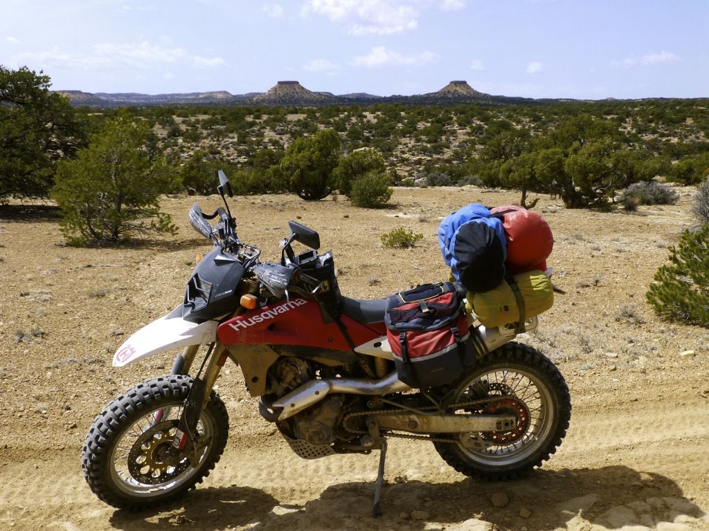
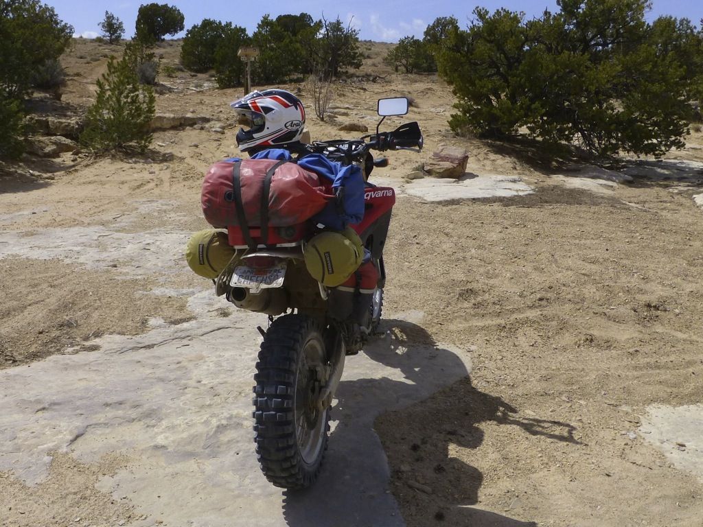
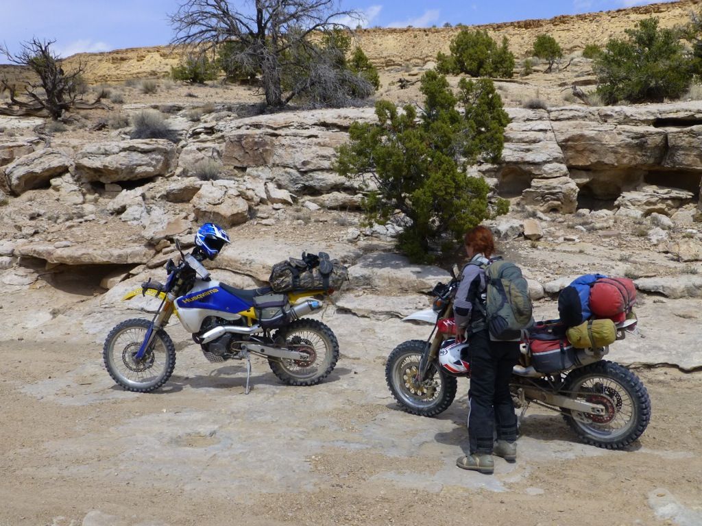
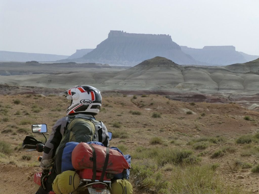
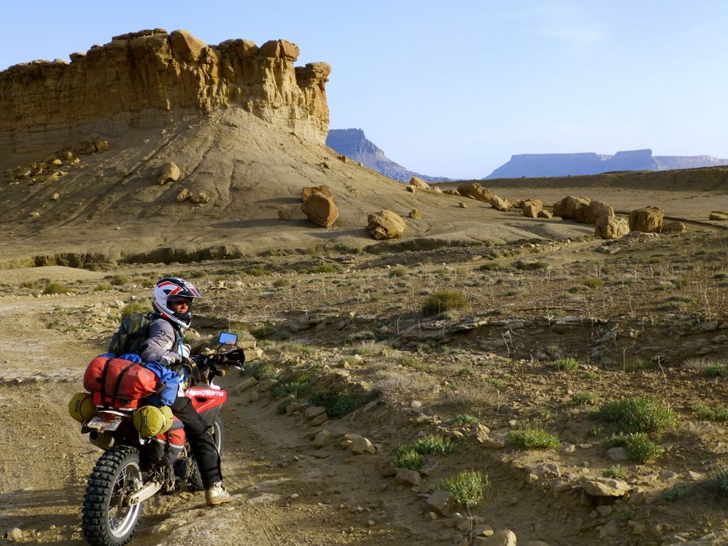
This little 3-night camping trip away from our base camp saw us put on 600 miles. We have about a 200-mile range and usually try to plan our routes to maximize our fuel. We try to avoid civilization unless we need fuel. It's hard to rack up the miles when the scenery is so interesting, though. No GPS, only maps and compass. We have one, but we rarely pull it out. We don't even have maps loaded on it

The whole motorcycle tourism thing in Utah is tricky. Moab is a bustling little town...super busy with all kinds of cool businesses...restaurants, bars, motels, inns, outdoor stores, tour companies, rafting outfits, etc. If it weren't for people enjoying the land and rivers that town would have blown away a long time ago. There is a huge enviro network in Utah, though, and every time we go there we see more and more Wilderness Study Area markers. Ride it while you can, man. You listening, bigjon? Don't wait. Do it today.
We slept hard after soaking all night. Took me forever to wake up! As soon as we fired up the 610s, though, I was ready to go. Rain and snow were forecasted for the evening so we were going to try to make it back to base camp. We'd planned on camping but didn't feel like eating another cold meal and having no coffee, especially if we were going to be wet and/or freezing.
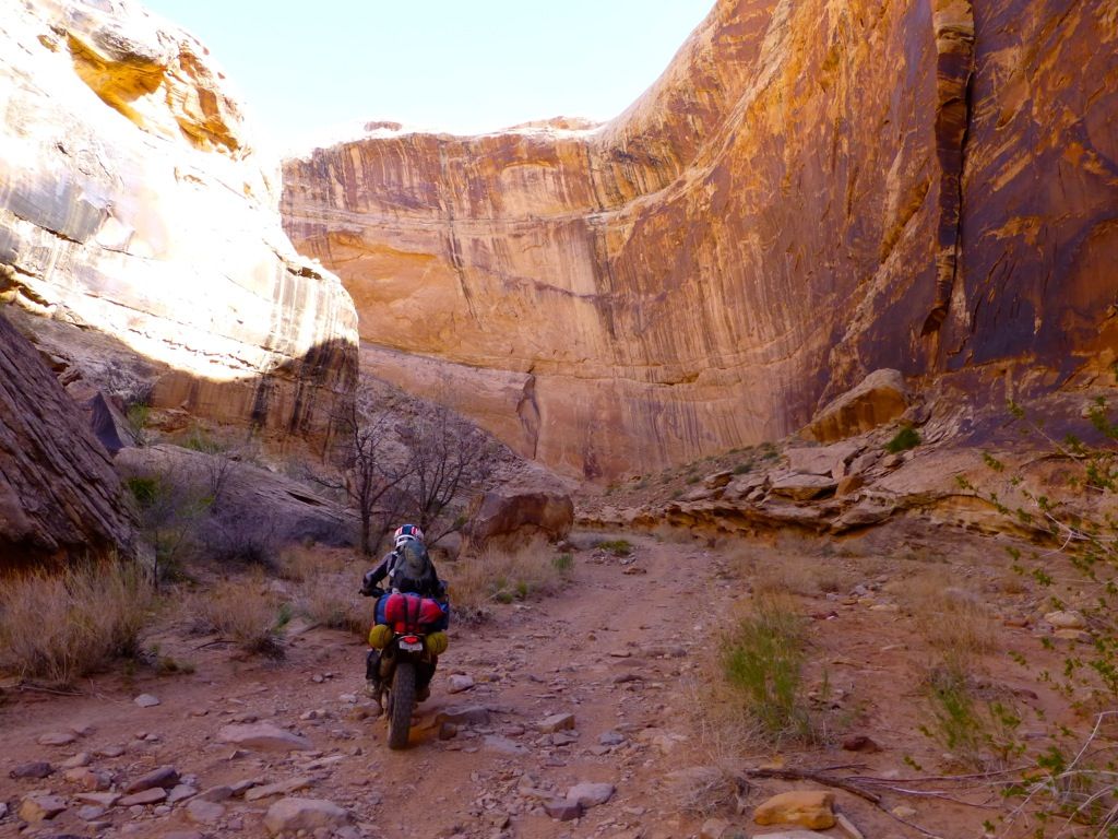
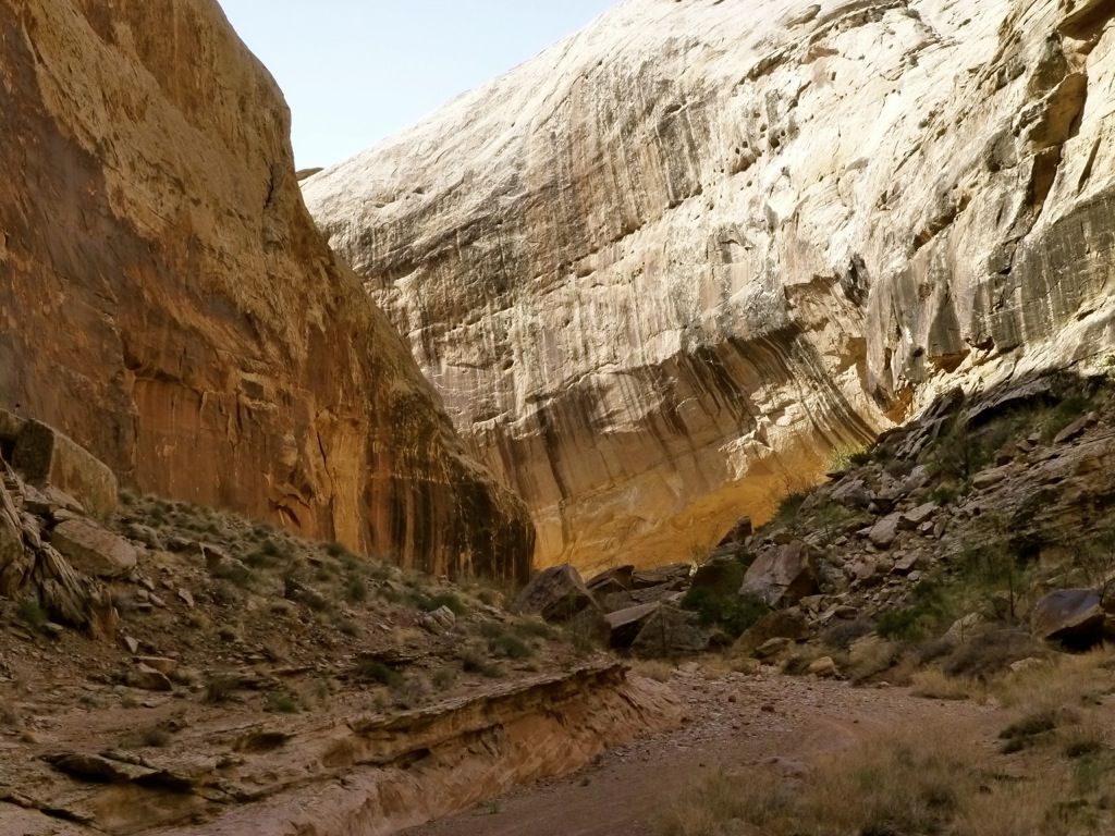
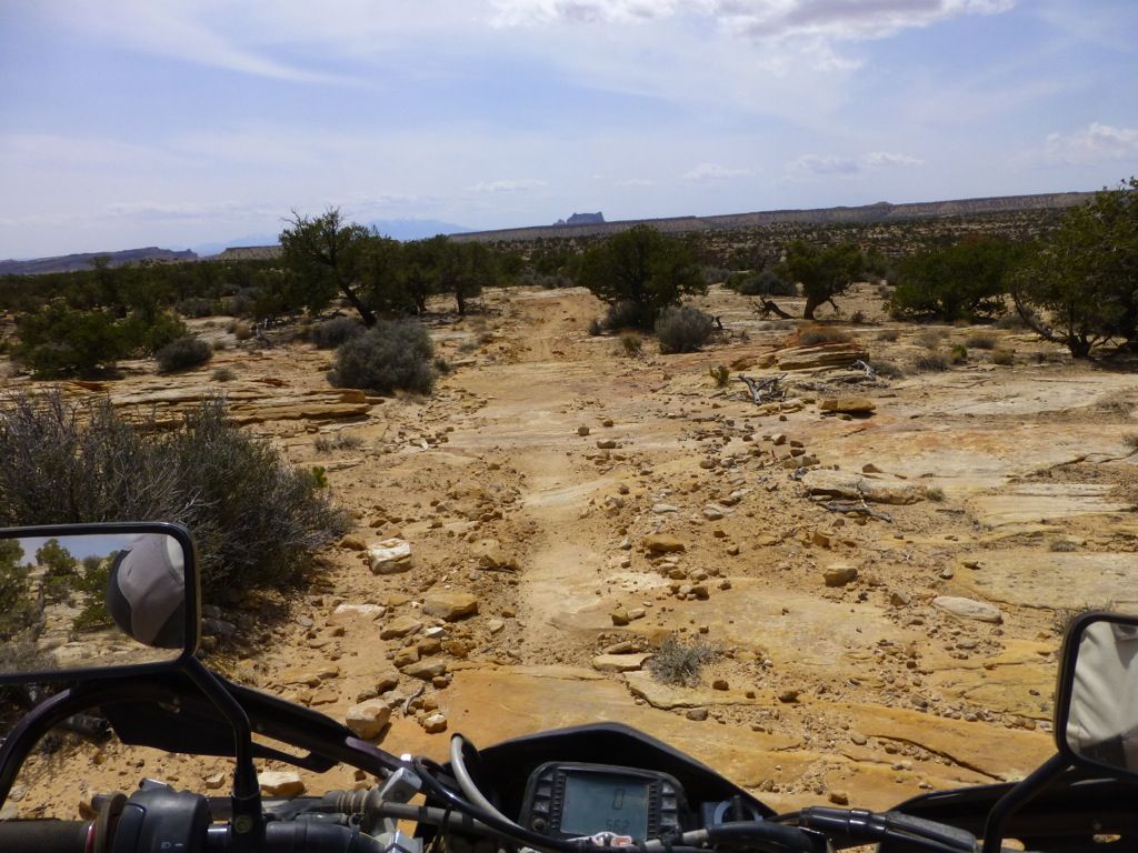
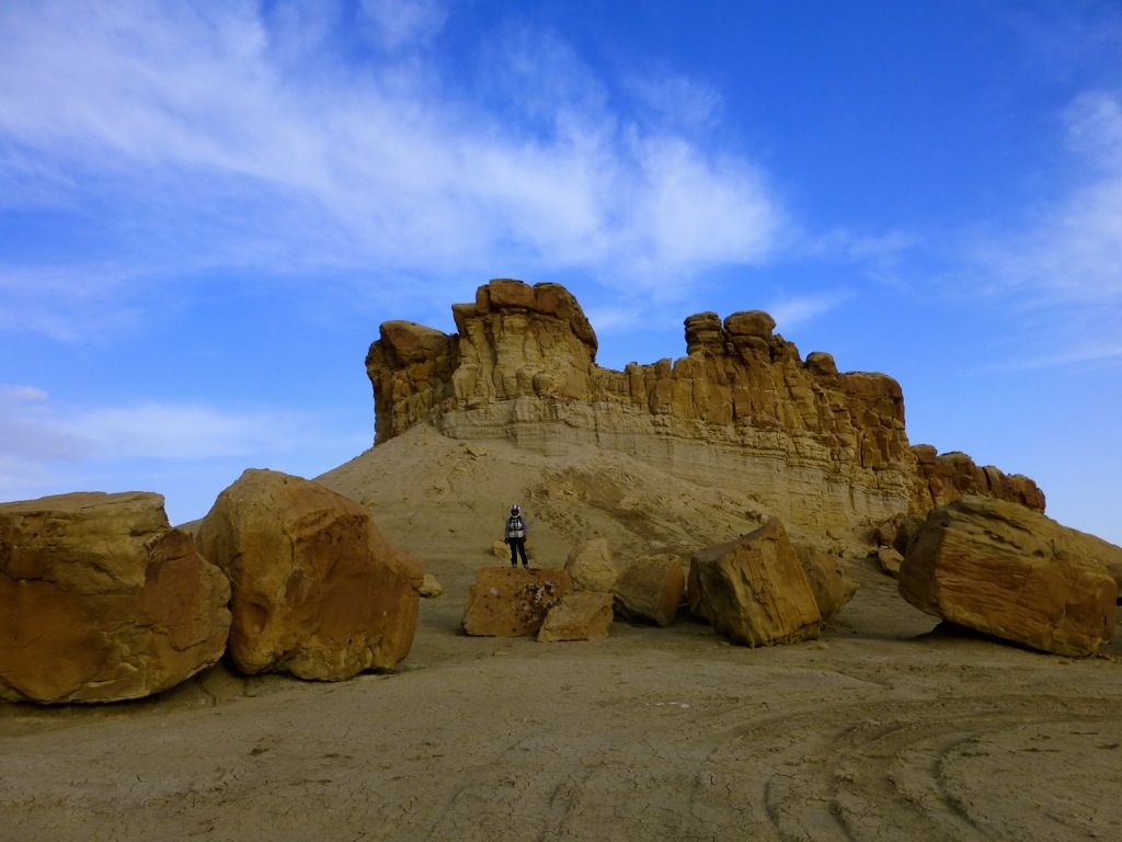
We headed west on 70 for a few miles, crossed the San Rafael River again and dropped down into a sand wash in search of a canyon that was rumored to contain some artwork. We played around on some slickrock before actually finding the entrance. The jagged pink rocks in the background are part of the San Rafael Reef...
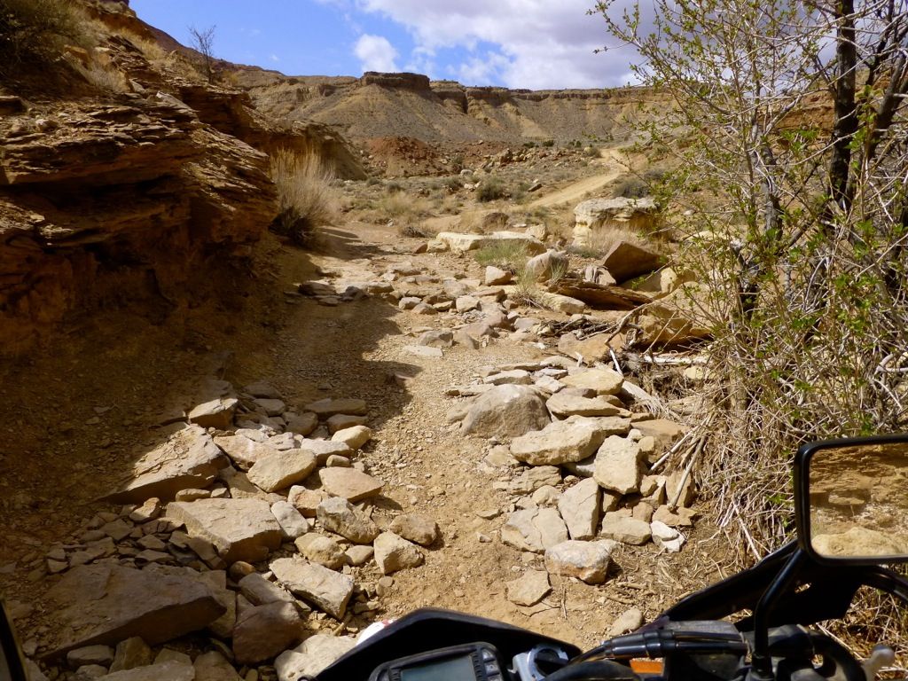
Yeah, it's kind of rocky down in the canyon...
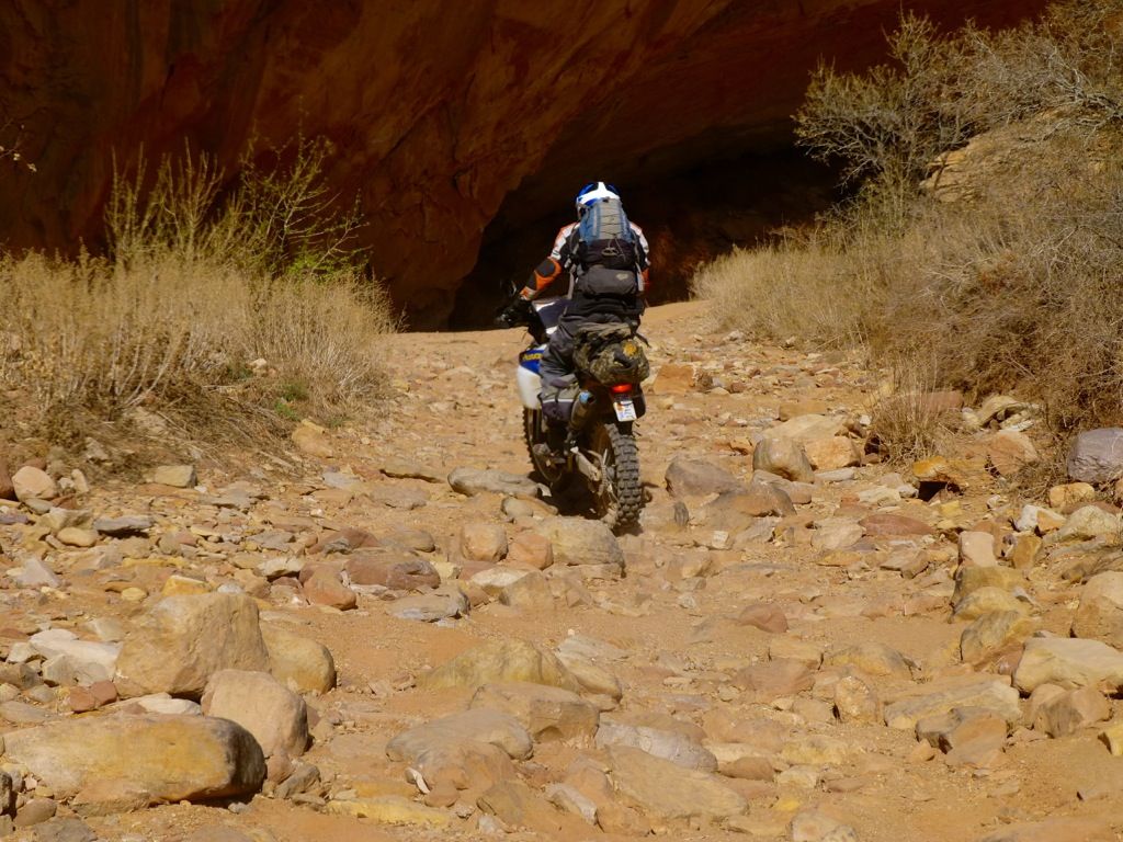
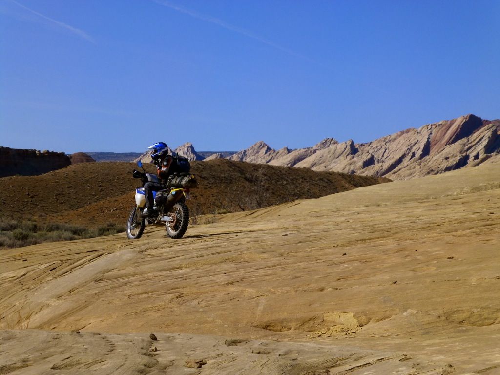
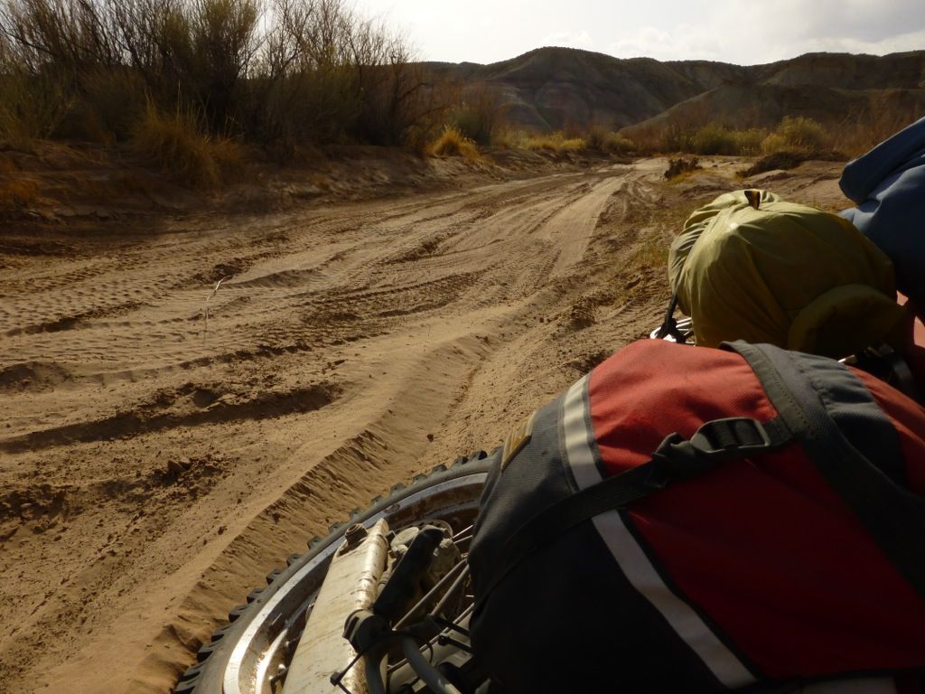
Rocks and sand...
Sand...
And rocks...
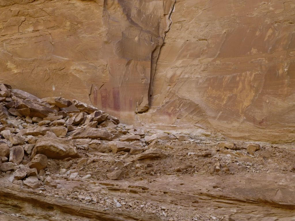
We'd found what we were looking for...
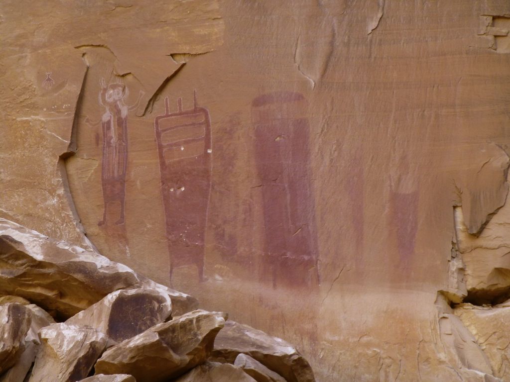
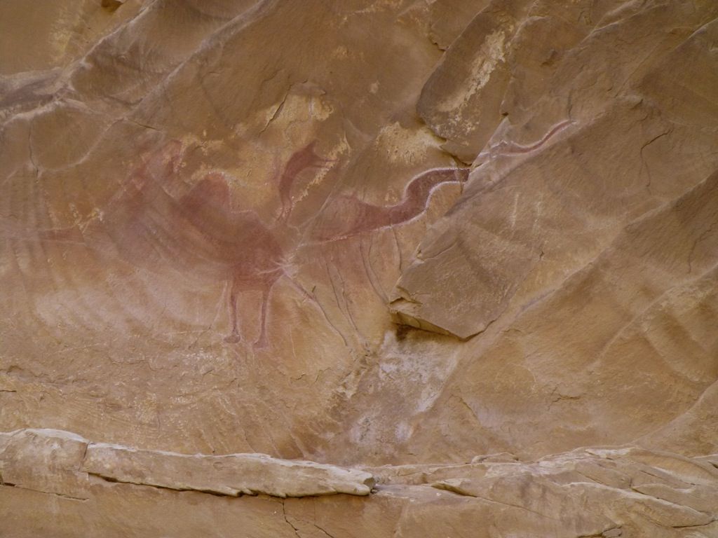
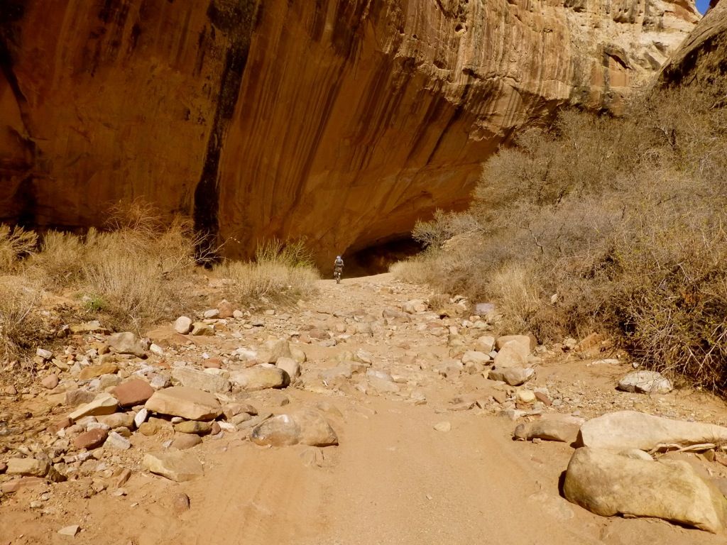
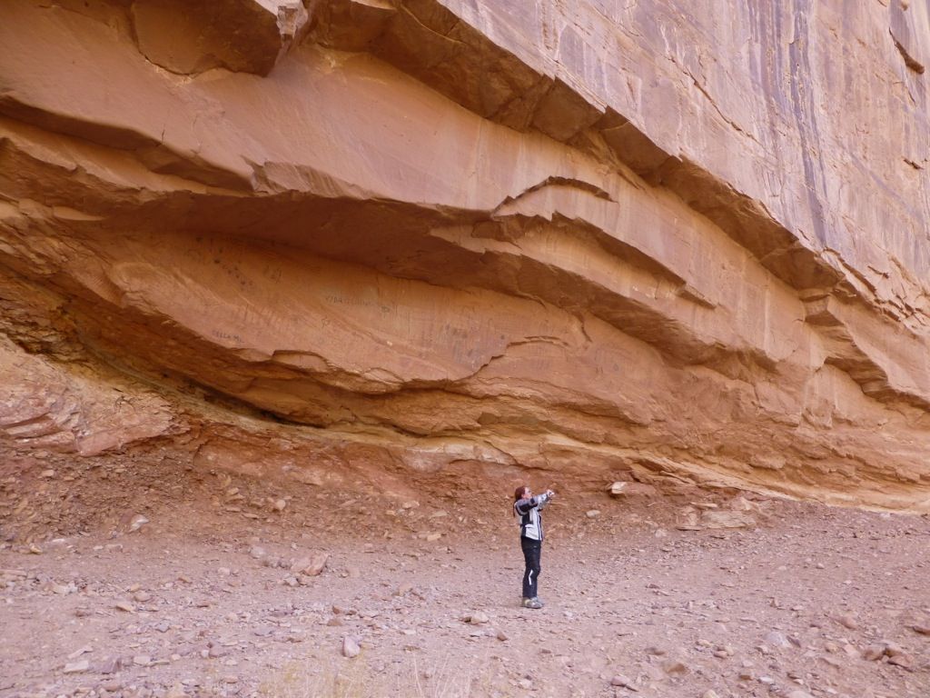
The scale of this canyon was really hard to capture...
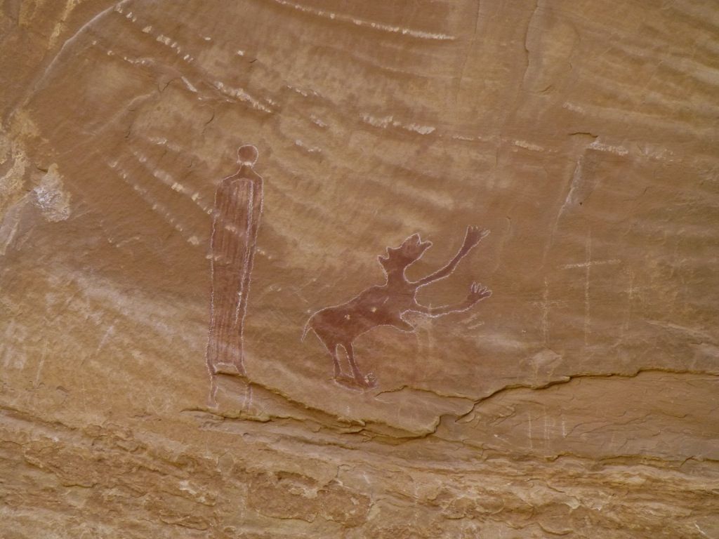
Love the hands!
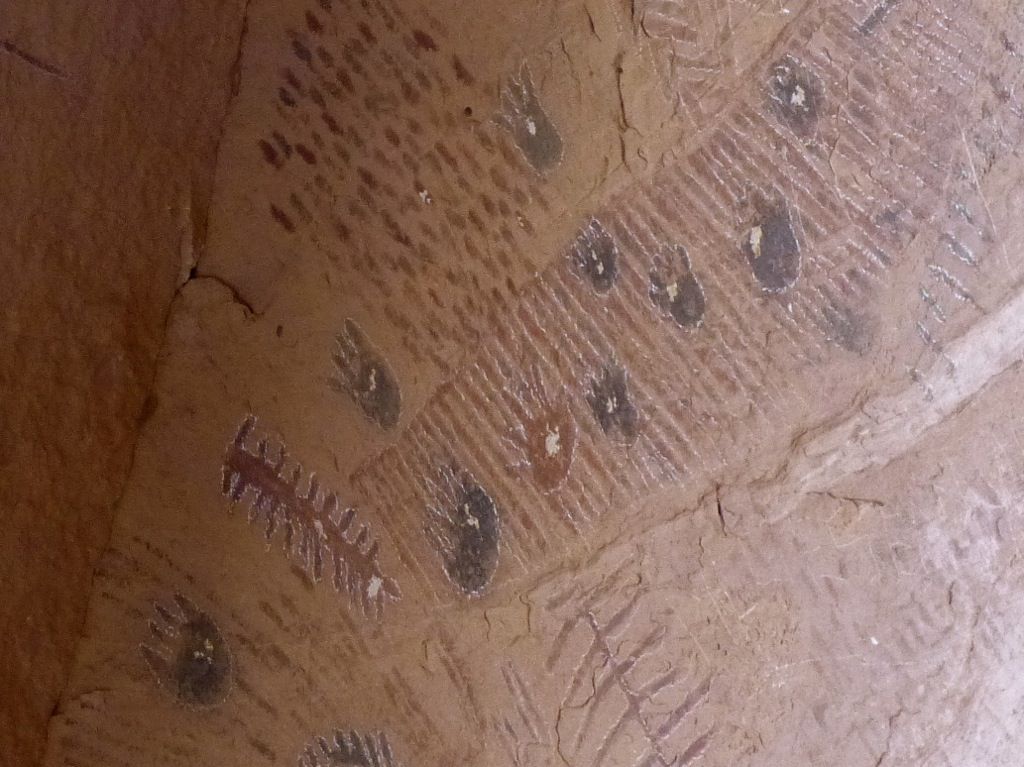

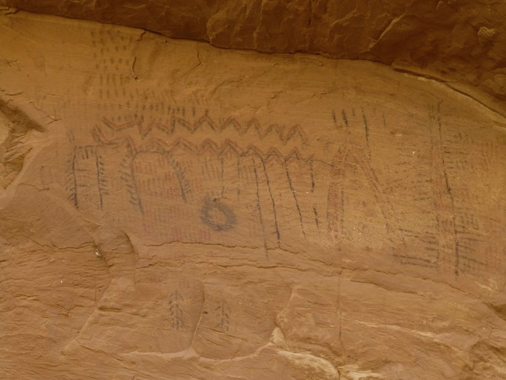
It was hard to leave the artwork, as there was so much to see! We had a big day ahead of us, though.
The canyon was beautiful, despite the harsh early morning light...
Oh, yeah!
I must have knocked over the cairn when I rode by...
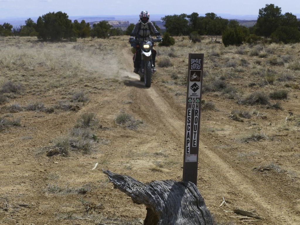
The canyon opened up nicely and now it was time to find our way over to the San Rafael Swell, home of the coolest trail ever... the infamous Five Miles Of Hell! http://www.utahtrials.com/5moh/5moh.html
We headed west on 70 for a few miles, crossed the San Rafael River again and dropped down into a sand wash in search of a canyon that was rumored to contain some artwork. We played around on some slickrock before actually finding the entrance. The jagged pink rocks in the background are part of the San Rafael Reef...
Yeah, it's kind of rocky down in the canyon...
Rocks and sand...
Sand...
And rocks...
We'd found what we were looking for...
The scale of this canyon was really hard to capture...
Love the hands!
It was hard to leave the artwork, as there was so much to see! We had a big day ahead of us, though.
The canyon was beautiful, despite the harsh early morning light...
Oh, yeah!
I must have knocked over the cairn when I rode by...
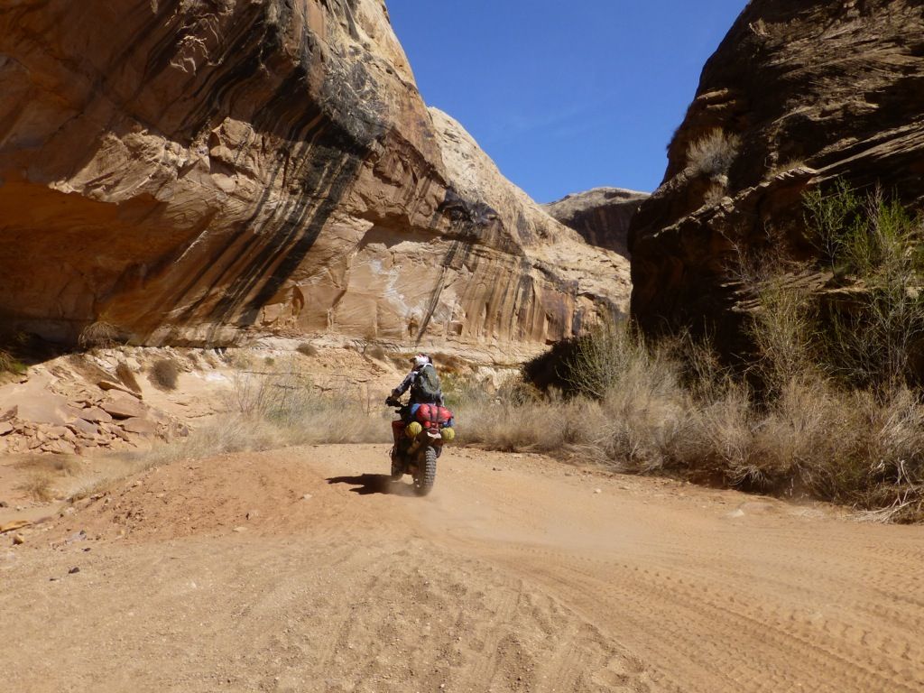
The canyon opened up nicely and now it was time to find our way over to the San Rafael Swell, home of the coolest trail ever... the infamous Five Miles Of Hell! http://www.utahtrials.com/5moh/5moh.html
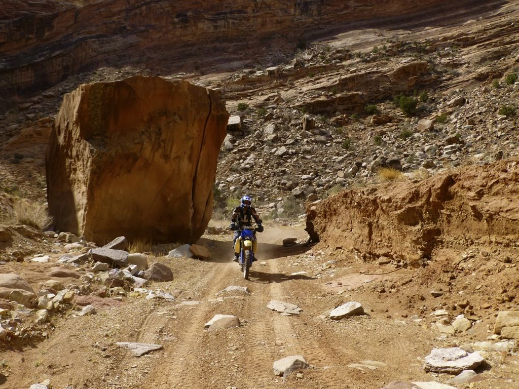
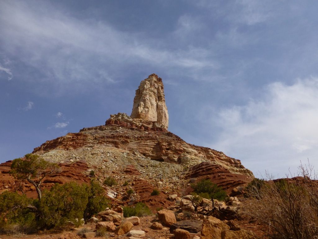
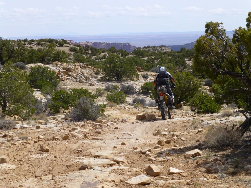
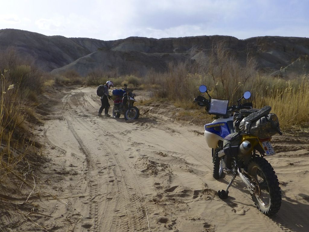
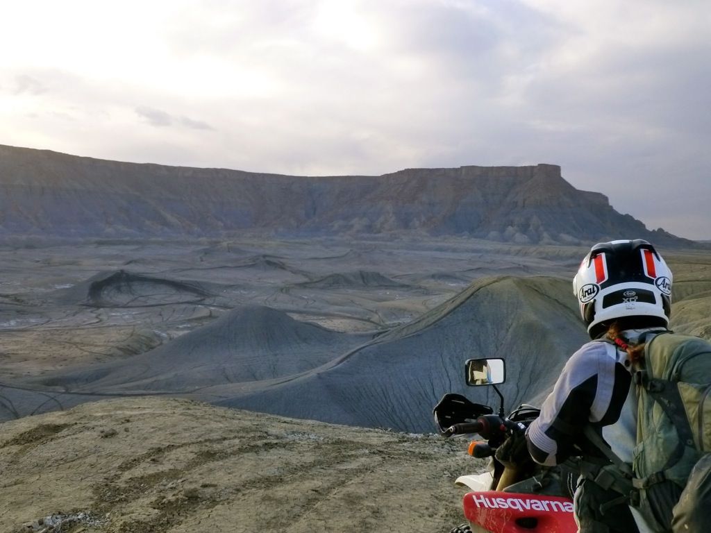
We exited the canyon, headed east and then south. We entered the San Rafael Swell from the north, and made our way south down towards Temple Mountain.
It was really cool to be in the Swell again. We'd been riding our dirt bikes here every spring but hadn't been back in a long time. It was neat to be there on a plated bike.
Lone Man...
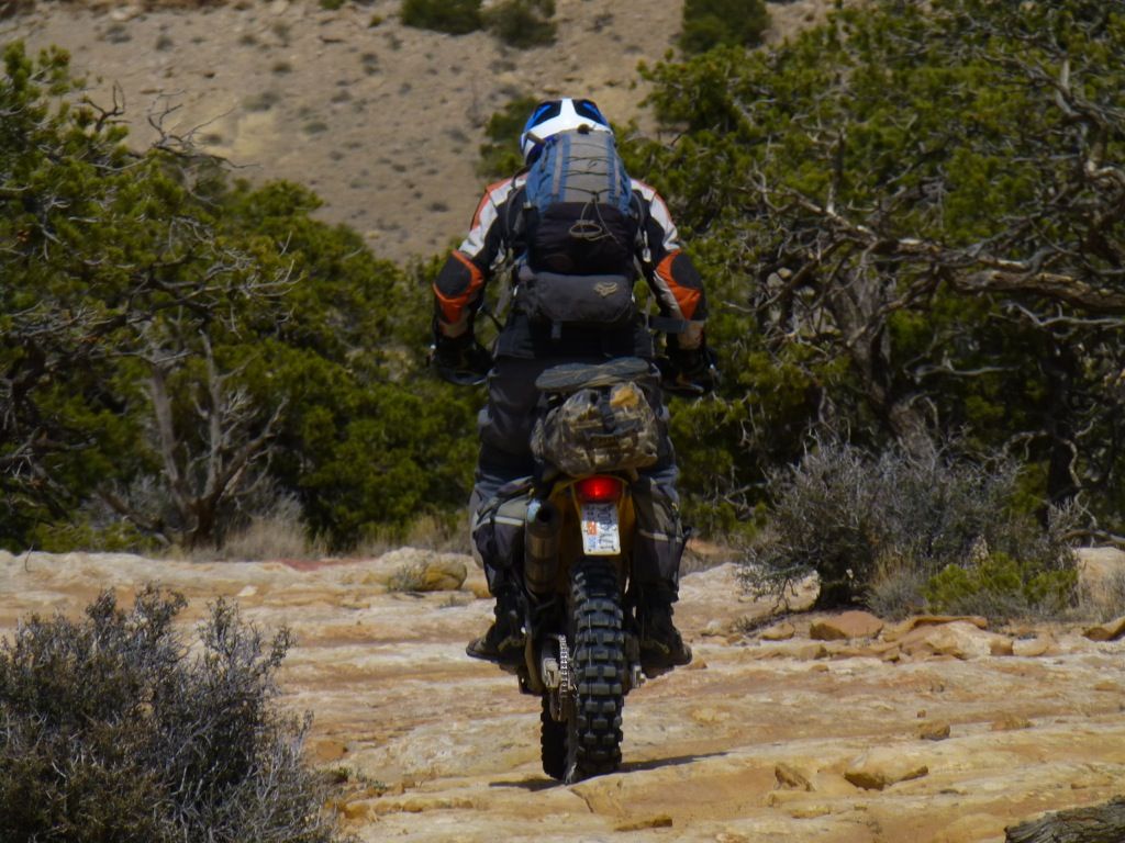
Oh boy, here we go...
Damn it! Wheelie photos of me are rare, and this was totally a missed opportunity. It was a good one, I swear!
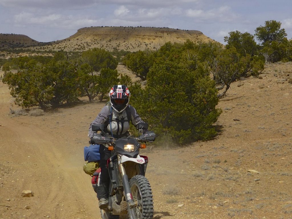
Twin Knolls off in the distance...
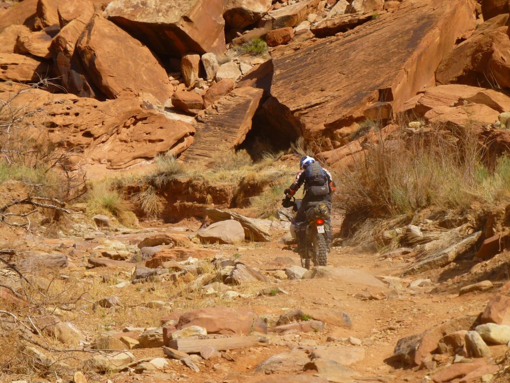
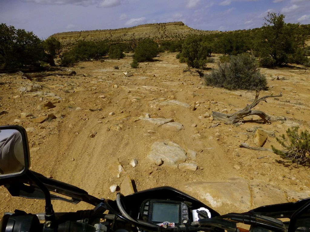
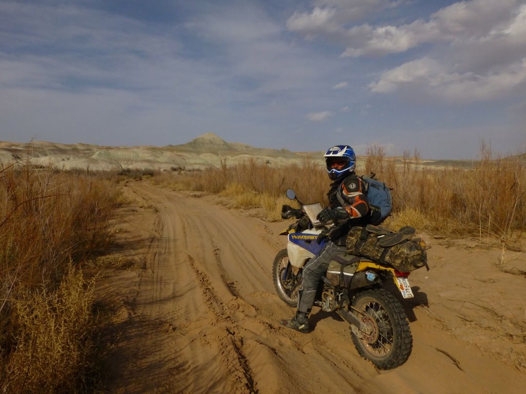
Nothing but rock out here...
Well...that's not true; there's a ton of sand, too...
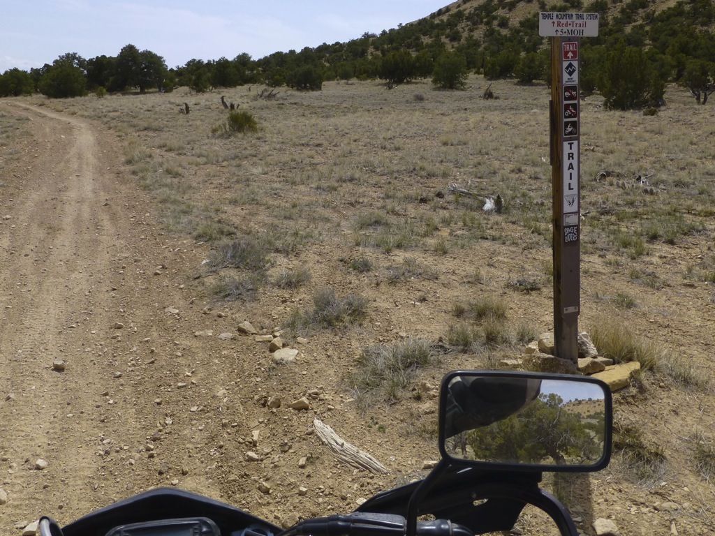
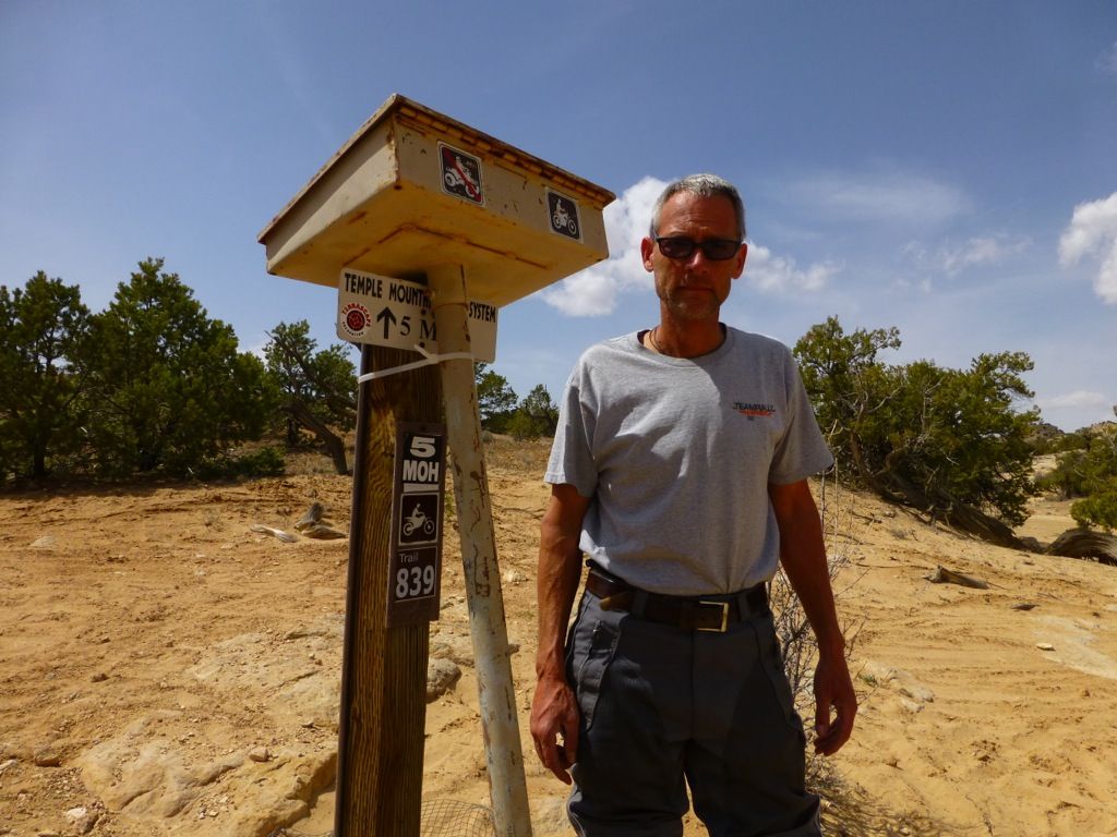
Eric is 6' even, and this is the sign-in box at the Five Miles of Hell (5MOH) trail...WTF?
Lone Man Wash...
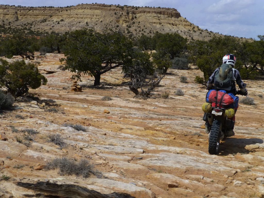
These little pink lovelies were everywhere!

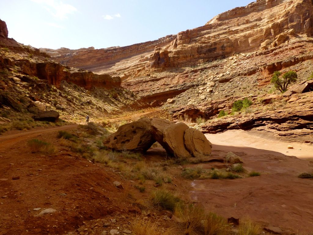
It never ends...
I thought I was on the trail, such as it was, til I saw the cairn way off to the side. The actual trail didn't look any different than what I was already on, though. Sometimes it's really hard to tell out here in the rock...

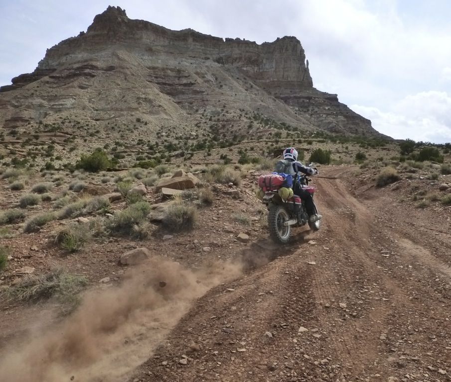
Heading up the backside of Temple Mountain...
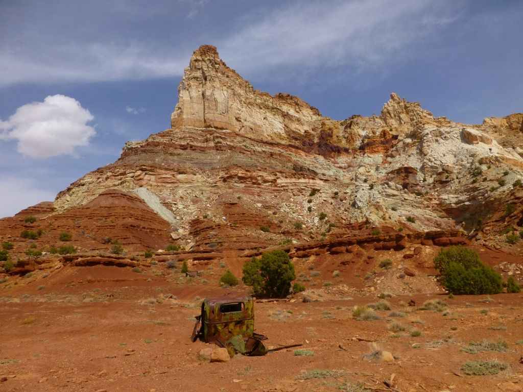
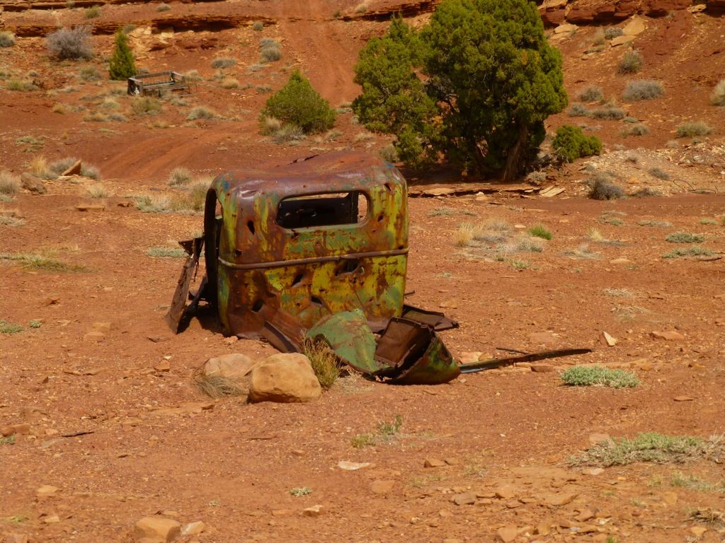
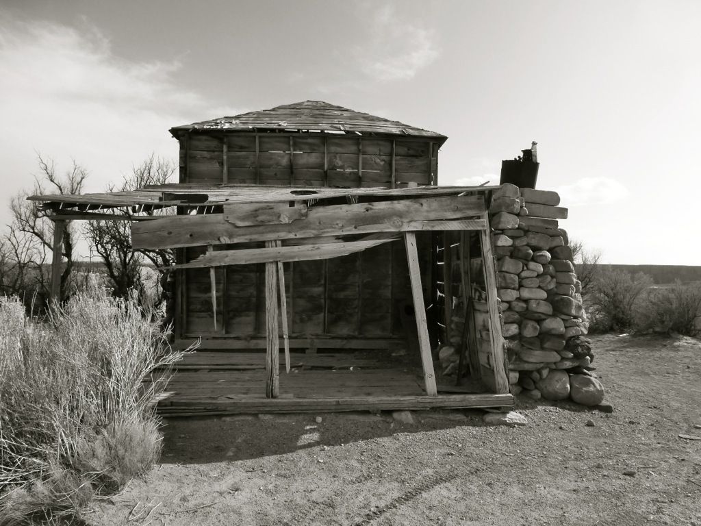
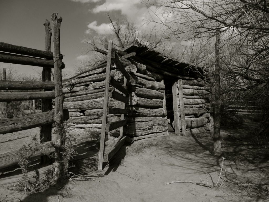
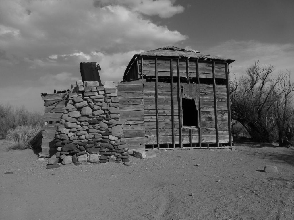
Note the road going up right behind the truck. This place was a booming uranium mining area and there are tons of big old American cars scattered throughout the area. Lots of mine remnants, old stone buildings...just all kinds of historical stuff. SUWA would like nothing more than to turn it into wilderness. Absurd...
More later tonight after sailing...unless we win and have to go to the yacht club to drink and claim our swag
It was really cool to be in the Swell again. We'd been riding our dirt bikes here every spring but hadn't been back in a long time. It was neat to be there on a plated bike.
Lone Man...
Oh boy, here we go...
Damn it! Wheelie photos of me are rare, and this was totally a missed opportunity. It was a good one, I swear!
Twin Knolls off in the distance...
Nothing but rock out here...
Well...that's not true; there's a ton of sand, too...
Eric is 6' even, and this is the sign-in box at the Five Miles of Hell (5MOH) trail...WTF?
Lone Man Wash...
These little pink lovelies were everywhere!
It never ends...
I thought I was on the trail, such as it was, til I saw the cairn way off to the side. The actual trail didn't look any different than what I was already on, though. Sometimes it's really hard to tell out here in the rock...
Heading up the backside of Temple Mountain...
Note the road going up right behind the truck. This place was a booming uranium mining area and there are tons of big old American cars scattered throughout the area. Lots of mine remnants, old stone buildings...just all kinds of historical stuff. SUWA would like nothing more than to turn it into wilderness. Absurd...
More later tonight after sailing...unless we win and have to go to the yacht club to drink and claim our swag
ray_ray
Mini-Sponsor
Hard to believe a human could live out there for any length of time ... In the case of the mining town, OK, but this would be short lived and well into the 1900s I'd guess ... Native Indians were doing that rock writing(?) long before mining and these people might have been out there for generations?
ray_ray
Mini-Sponsor
Note the road going up right behind the truck. This place was a booming uranium mining area and there are tons of big old American cars scattered throughout the area. Lots of mine remnants, old stone buildings...just all kinds of historical stuff. SUWA would like nothing more than to turn it into wilderness. Absurd...
Absurd with some ignorance and egos at play that apparently think they were born to save the planet? God knows I'd hate to be on that quest :0) ... A squadron of B52s could not hurt that huge rock ...It could only roll the rocks around and just add more features and down the road, you'll never know they were there ...
That area will never have too many passing through now I'd guess as it is just too un-forgiving terrain for most ... You can't even carry much on a bike to even leave behind if you wanted to leave it behind ... The trail signs look really helpful out there but a single sign at an entry point saying "You are own your own now" or "Enter at your own risk" would be adequate also. You are risking your life out there just crossing and that point is never, never brought up by egos wanting to stop all access to these type places ...
I really enjoy your ride reports, the pictures are fantastic. Something I hadn't noticed until now is your front tyre? Whats the go there?
Thanks, Kreza!
") My 610 is an SM model with 17" wheels. I just throw 17" knobbies on it when I'm going to be on dirt and/or sand. I was running Cheng Shin knobbies on this trip, a 4.60 front and a 5.30 rear.
My 610 is an SM model with 17" wheels. I just throw 17" knobbies on it when I'm going to be on dirt and/or sand. I was running Cheng Shin knobbies on this trip, a 4.60 front and a 5.30 rear.Hard to believe a human could live out there for any length of time ... In the case of the mining town, OK, but this would be short lived and well into the 1900s I'd guess ... Native Indians were doing that rock writing(?) long before mining and these people might have been out there for generations?
Yeah, the place was a big uranium producer. It sort of folded in the 20's but ramped back up big-time in the 50's and early 60's.
And ray_ray, the thing about turning it into wilderness is that it will become inaccessible for most people. There is not much water to be had so hiking for any length of time would be burdensome. Most of the people that use the land out there are either on bicycles, motorcycles or 4WD's. Ahh...there's a good reason for legislating in some de facto wilderness, eh? 
More later tonight after sailing...unless we win and have to go to the yacht club to drink and claim our swag
Well, we didn't win but we came in 2nd so there was some celebrating to be done

And yeah, I know it's off-topic but it's my ride report so I'm going to post it anyway


I'll try to get another post out before softball tonight!
wallybean
Mini-Sponsor
Sailing in the bay is a blast. Had a great Bud when I was much younger who lived in SF and had a boat in one of the yacht clubs and we would sail, stop for drinks, sail and get back and party. Great fun!Well, we didn't win but we came in 2nd so there was some celebrating to be done
And yeah, I know it's off-topic but it's my ride report so I'm going to post it anyway
View attachment 27224
I'll try to get another post out before softball tonight!
Xcuvator
Husqvarna
Pro Class
I hope your "Bud" was really a Bud.Sailing in the bay is a blast. Had a great Bud when I was much younger who lived in SF and had a boat in one of the yacht clubs and we would sail, stop for drinks, sail and get back and party. Great fun!
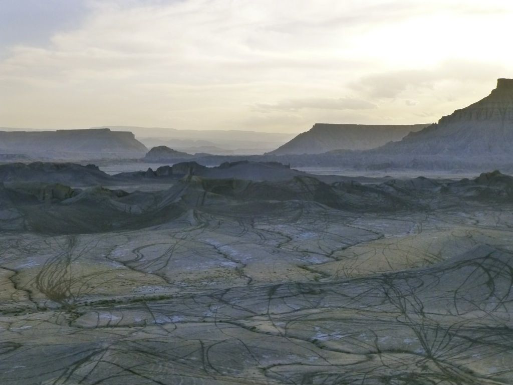
We shot out of Temple Mountain, passed by Goblin Valley, and pretty much strafed Little Wild Horse Canyon. We didn't stop for one photo...can you believe that? Twisty, sandy, good flow...just a huge ball of fun. The terrain changes quick out here, especially when you're bookin'. All of a sudden we were in stuff like this, Factory Butte in the distance...
Nobody was home...
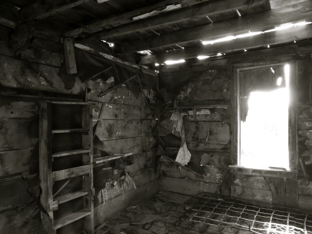
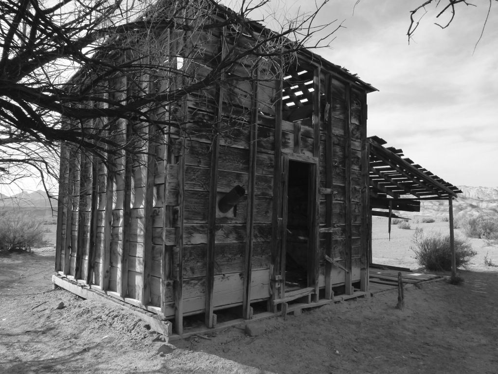
This was a really sweet spot for a home, not far from the banks of Muddy Creek. I wonder if it broke someone's heart when they had to just walk away from it?
We went to cross the creek but the ford was gone. In its place was a 5' cut bank with some deep water in the curve. Looking upstream and down showed nothing different. Hmm...guess we'll just have to ride around in really deep sand and tall brush looking for a way across. Great. Did I mention it was getting pretty toasty? The bikes were getting hot plowing through all the sand, too. It was deep and never-ending...
I wasn't the only one on the floor. Eric just happens to be able to pick his bike up faster than I can...
We finally found a spot to cross and we walked it just to make sure it wasn't some bike-eating hidden quagmire...
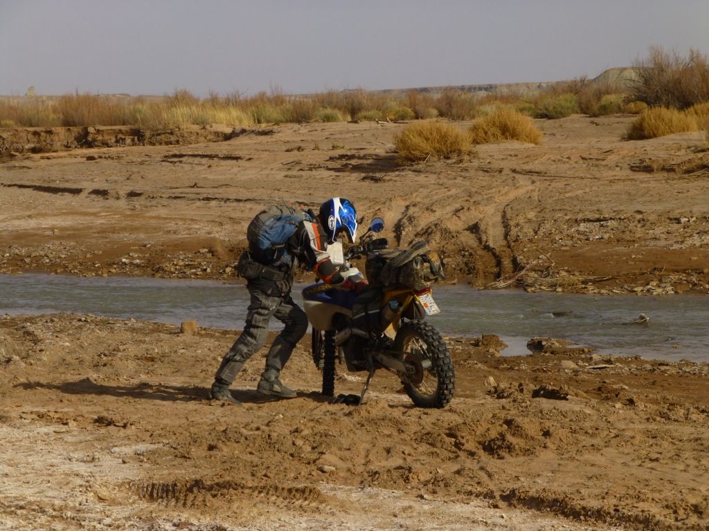
Turns out the sand was kinda deep and the mud sticky but the creek crossing was smooth rocks. Nothing tricky except for deep sand on the other side.
I've got video of the crossings but I'm having an issue posting to youtube so they'll have to wait.
Rocks!
We saw a huge fenced-in area and had to investigate. There were bathrooms and an information kiosk. Turns out it was an OHV area! This is Swingarm City, also known as Hanksville. Pretty wild stuff!
Crazy place...looks like the moon. The razor-thin ridges are wild!
I took no more photos this day. We hauled it all the way back to our home base camp down on the edge of the Capitol Reef, arriving long after dark. It was a long day, about 12 hours in the saddle, and a few hundred miles. All together it was 600 miles for the 3 nights, and almost all of it was dirt :Party
Oh, and we may have gotten back after dark, but at least it was before the rains came
Nobody was home...
This was a really sweet spot for a home, not far from the banks of Muddy Creek. I wonder if it broke someone's heart when they had to just walk away from it?
We went to cross the creek but the ford was gone. In its place was a 5' cut bank with some deep water in the curve. Looking upstream and down showed nothing different. Hmm...guess we'll just have to ride around in really deep sand and tall brush looking for a way across. Great. Did I mention it was getting pretty toasty? The bikes were getting hot plowing through all the sand, too. It was deep and never-ending...
I wasn't the only one on the floor. Eric just happens to be able to pick his bike up faster than I can...
We finally found a spot to cross and we walked it just to make sure it wasn't some bike-eating hidden quagmire...
Turns out the sand was kinda deep and the mud sticky but the creek crossing was smooth rocks. Nothing tricky except for deep sand on the other side.
I've got video of the crossings but I'm having an issue posting to youtube so they'll have to wait.
Rocks!
We saw a huge fenced-in area and had to investigate. There were bathrooms and an information kiosk. Turns out it was an OHV area! This is Swingarm City, also known as Hanksville. Pretty wild stuff!
Crazy place...looks like the moon. The razor-thin ridges are wild!
I took no more photos this day. We hauled it all the way back to our home base camp down on the edge of the Capitol Reef, arriving long after dark. It was a long day, about 12 hours in the saddle, and a few hundred miles. All together it was 600 miles for the 3 nights, and almost all of it was dirt :Party
Oh, and we may have gotten back after dark, but at least it was before the rains came
Clete
Husqvarna
AA Class
I really enjoy your ride reports, the pictures are fantastic.
I second that. Amazing how much you guys ride. And sailing too!
