ray_ray
Mini-Sponsor
It started raining here so it must the rainy season? Anyway, I've been wanting to go across the highland roads again after their grading a few months back. There's lots of raw dirt up there and with the last few days of general raining here, my ~new 19" rear knobby, and a 2010 TC250 Husky, the dirtbike riding table is set.
This ride also goes to Tag Hill using what I call the Outer Lusaran Loop route ... One of about 6 different variations for the trip over to Tag... Mountains are about 2800' high across here I rode...
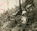
One ridge line over is Mount Manunggal at a height of ~3100' .. In 1957 a plane carrying the Filipino president crashed here.

They removed the bodies and left the wreckage there I think and it has just recently all melted away. You can also see it had all been logged out by '57 ...
--
Camera was bad that day so mostly videos ...

Traction was plentiful and looked like rain but never happened ... Just lots of clouds adding to the view.

This ride also goes to Tag Hill using what I call the Outer Lusaran Loop route ... One of about 6 different variations for the trip over to Tag... Mountains are about 2800' high across here I rode...
One ridge line over is Mount Manunggal at a height of ~3100' .. In 1957 a plane carrying the Filipino president crashed here.

They removed the bodies and left the wreckage there I think and it has just recently all melted away. You can also see it had all been logged out by '57 ...
--
Camera was bad that day so mostly videos ...

Traction was plentiful and looked like rain but never happened ... Just lots of clouds adding to the view.


