Ha. Looks like everyone has met the sheep!
Hell no I dont know where I'm going! Luckily my friend Brian did or we'd probably be living out there right now.
I love solo riding and I do it quite often, but I would pass on a solo ride out there. It's too big and desolate for my liking and one misstep could make for a very bad day.
I do recommended you grab a buddy and check it out though. I have the gpx file from my Garmin I could send you and/or I could get you in touch with my buddy Brian. I also have a bunch of gpx files for the mammoth area too. Just let me know....
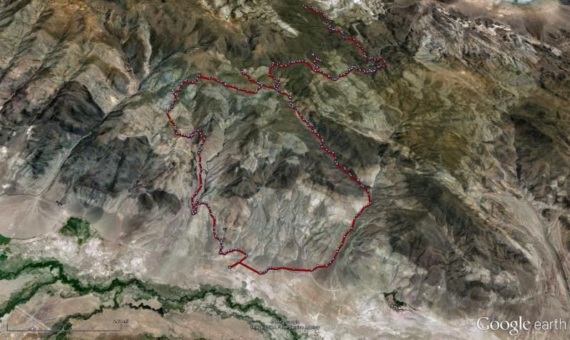
Here's a snapshot of our route that day. You can see the Bishop airport in the bottom left of the screen, so where we staged is just minutes from town.
There's also a bunch of fun single track just west of Bishop in the cascade foothills. I forget the name of the hills, but they're the ones you access off Round Valley Rd. maybe 10 miles from town. I would ride here solo as its much less elevation and much closer to civilization and you could easily walk out if need be. The whites are huge and it would be real easy to lose your bearings and walk the wrong direction. That aint gonna happen in these foothills as you have the Sierra's to the S and W and Hwy 395 to the N and E and there's no 3k' deep valleys to block your views. Be safe if you go and let me know if you want those gps tracks.
Hell no I dont know where I'm going! Luckily my friend Brian did or we'd probably be living out there right now.
I love solo riding and I do it quite often, but I would pass on a solo ride out there. It's too big and desolate for my liking and one misstep could make for a very bad day.
I do recommended you grab a buddy and check it out though. I have the gpx file from my Garmin I could send you and/or I could get you in touch with my buddy Brian. I also have a bunch of gpx files for the mammoth area too. Just let me know....
Here's a snapshot of our route that day. You can see the Bishop airport in the bottom left of the screen, so where we staged is just minutes from town.
There's also a bunch of fun single track just west of Bishop in the cascade foothills. I forget the name of the hills, but they're the ones you access off Round Valley Rd. maybe 10 miles from town. I would ride here solo as its much less elevation and much closer to civilization and you could easily walk out if need be. The whites are huge and it would be real easy to lose your bearings and walk the wrong direction. That aint gonna happen in these foothills as you have the Sierra's to the S and W and Hwy 395 to the N and E and there's no 3k' deep valleys to block your views. Be safe if you go and let me know if you want those gps tracks.